When a Boundary Followed the River
River boundary rules depend on the original wording and local law. Learn how to read changing channels, islands, maps, and official records with care.
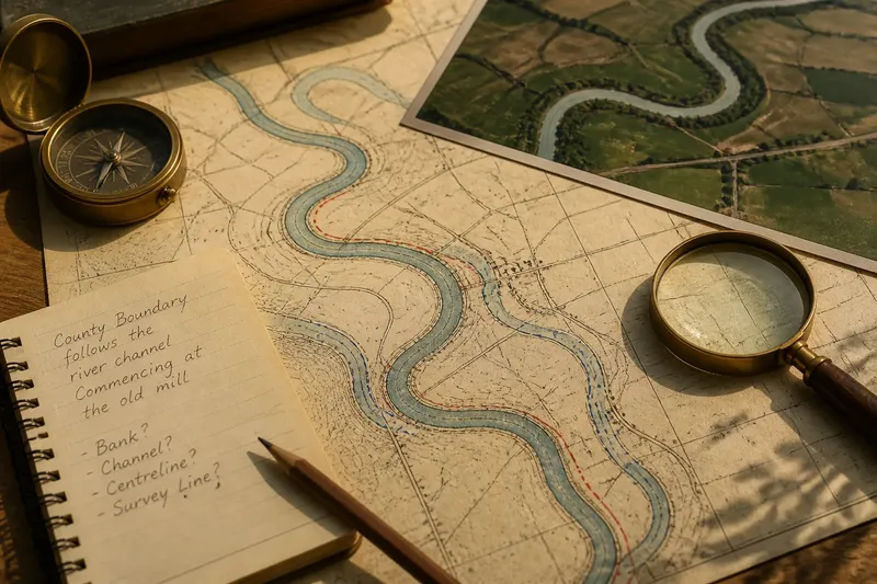
A blue line bends around a farm on an old county map, while the river itself now runs closer to the road. That gap is why a river boundary cannot be located by tracing today’s water alone. The river boundary may follow a channel, a bank, or a fixed surveyed line, depending on the governing description and applicable law.
Why rivers mark borders
A named river can be easier to recognize on the ground than an abstract line across woods or fields. It may also separate settlements whose roads, farms, and everyday travel connect to different centers. For mapmakers and neighboring authorities, the watercourse offers a visible reference point—but not necessarily a stable one.
Boundary descriptions vary. One may name a bank, a channel, a centerline, or coordinates on a survey. Those choices matter: a bank boundary and a centerline boundary can divide the same stretch of water differently. A general map’s blue symbol usually identifies the river for orientation, not the legally controlling line.
Channel wording matters
“The middle of the river” sounds clear until a river has several branches, shifting sandbars, or broad stretches without one obvious central current. A legal text might instead refer to a main channel, a navigable channel, a particular bank, or a surveyed line. The precise wording and its legal interpretation matter more than an informal reading of the map.
Look for the source that created or records the boundary: perhaps a treaty, statute, deed, survey, boundary commission report, or official cadastral map. The relevant documents differ by place, and a general-purpose map may omit the detail needed to distinguish a channel from a fixed line.
Gradual drift and sudden change
Currents can slowly erode one bank and deposit sediment on another. This gradual change is often described as accretion or erosion. A river can also shift abruptly into a new course, leaving a former channel behind; this sudden change is commonly called avulsion. Some legal systems distinguish these processes, but there is no universal rule for how either affects a boundary.
A line may track a gradually changing channel, stay at its former position, or be treated differently after an abrupt shift. The result can depend on the original wording, local law, treaties, and evidence about the physical change. A current map can show where water flows now; by itself, it cannot establish where the legal boundary lies. For a real property or jurisdictional dispute, consult the relevant public boundary office or a qualified local legal professional.
Say a county description, in an invented situation, says its boundary follows a river channel but does not spell out what happens after a sudden course change. The starting point is the old channel shown on a dated survey and a new channel visible on current imagery. First, compare the description with the survey to see what feature it identifies; next, review records that could establish whether the change was gradual or abrupt; then ask the responsible boundary office or a qualified local professional how local law treats that wording and evidence. The resulting answer may be that the line tracks the channel, remains at the surveyed location, or needs formal determination—the new watercourse alone does not decide it.
Islands and branching channels
An island can split a river into channels, making “the middle” harder to locate. A boundary description may identify a main channel or use another rule; the island’s formation and the boundary’s history may also matter. A seasonal branch that carries water only after heavy rain does not automatically count as the boundary channel.
Historical maps, surveys, navigation records, and the governing description can help clarify which channel is relevant. Each source has limits: a map may show a former course without defining the legal line, while a survey may describe a particular point in time.
Reading river boundary maps
For a geographic overview, compare maps from different periods. Note where bends have been cut off, channels have split, or banks appear to have shifted. Aerial imagery can help show the present watercourse; older maps can suggest how it looked before. Treat both as evidence about the landscape, not as automatic proof of the legal boundary.
- Check whether the official description names a bank, channel, centerline, or coordinates; if it names a specific feature, compare that feature with the map, and if the wording is unclear, seek the underlying record or qualified local interpretation.
- Check whether a map is an official boundary record or a general reference map; if it is official and relevant to the boundary, use it alongside the governing text, and if it is general-purpose, use it only to orient yourself.
- Check whether older and newer maps show a channel shift; if they do, compare the dates and look for records explaining the change, and if they do not, avoid assuming that the legal line moved.
- Check whether the river divides around an island; if it does, look for wording or records identifying the relevant channel, and if none does, do not choose a branch based only on appearance.
- Check whether records describe gradual erosion or an abrupt change; if they do, bring that distinction to the responsible office or a qualified local professional, and if they do not, treat the channel history as unresolved.
- Check whether a property or jurisdictional decision depends on the exact line; if it does, request an authoritative determination or qualified legal advice, and if it does not, label the map reading as a geographic interpretation rather than a legal conclusion.
It is not worth trying to settle a disputed line by zooming in on a phone map or comparing blue pixels. Those tools can show where water appears to be, but not which legal description controls.
What readers ask?
Does a river boundary always move with the river?
No. Some boundaries may follow gradual channel movement, while others remain fixed or follow special rules. The governing description and applicable local law determine how a particular change is treated.
Is the boundary always in the river’s center?
No. It may follow a bank, a centerline, a specified channel, or a fixed surveyed line. The map symbol alone does not show which rule applies.
What if a river suddenly changes course?
A sudden shift may be treated differently from gradual erosion or deposition, but the legal result varies by jurisdiction. The relevant wording, local law, and evidence about the change need to be considered together.
Can a map settle a river boundary dispute?
A map can help explain the landscape, but a general map may be too simplified to establish a legal boundary. Consult the governing documents and relevant public office, or a qualified local legal professional if the line affects a real dispute.
Visible water, legal line
A river boundary joins a rule to a landscape that can change. The watercourse may remain a useful clue to where neighboring places meet, but bends, islands, and abandoned channels can expose the difference between a visible feature and an official line.
When reading a river boundary, start with the words and records that established it, then use maps to understand the river’s history. That order keeps a striking change in the landscape from being mistaken for a legal decision.