Reading Ridge and Valley Contour Lines on a Topographic Map
Read ridge and valley contour lines to identify slope, drainage direction, and the terrain a topographic map leaves out before interpreting the landscape.
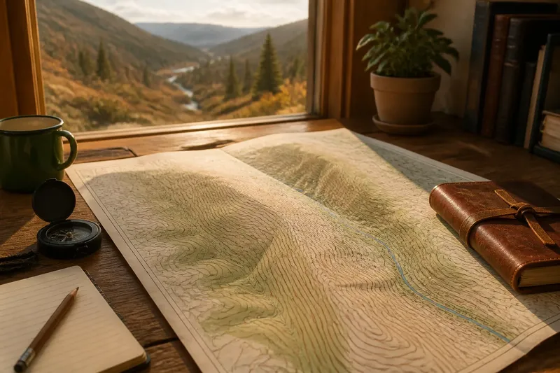
At the kitchen table, a topographic map shows a ridge curving above a creek, its contour lines crowded on one side and spread out on the other. Reading ridge and valley contour lines means following those curves as a connected shape, not treating each bend as a separate clue.
Start with the interval
Contour lines trace locations at the same elevation. The legend gives the contour interval: the vertical change from one line to the next. Check it before interpreting the pattern, since the interval determines how much elevation change each gap represents.
Closely spaced lines indicate a steep slope; wider spacing suggests gentler ground. Compare neighboring slopes rather than judging one patch alone. A tightly curved band beside a creek may describe a valley wall, while a similar band on the far side of a ridge describes steep ground in another direction.
A broad area with sparse contours can look nearly level, but small rises and hollows may be too subtle for the map’s scale or interval to show. Spacing gives a useful relative impression, not a complete description of the terrain.
Follow each bend
Nested closed contours often mark a hill or peak. Elevation labels help confirm which way is uphill. On a ridge, elongated contours extend from higher ground; their bends generally point downhill as the land projects between lower areas.
Valley contours usually form V shapes where they cross a stream or drainage. The point of the V faces uphill, toward the stream’s source; its open end faces downhill. Trace several lines and compare them with the mapped drainage, if one appears. A map may show intermittent channels or leave small ones out, so a missing stream does not settle the question by itself.
Trace the connected landforms
A ridge divides drainage, while adjoining valleys collect it. Follow the contours along the higher ground, then watch how their bends descend toward the channel. Where side slopes converge, water is directed toward lower terrain; where a ridge branches, it separates neighboring drainage paths.
Imagine a map with a long ridge and a narrow stream valley on its eastern side. The map’s contour interval is labeled, and several V-shaped bends point west, toward higher ground. Following the drainage pattern indicates that the stream descends eastward. If the eastern valley wall has closer contours than the western wall, the map depicts it as steeper; it does not reveal whether either slope is wooded, rocky, or altered by a cut bank.
Respect map limits
Contours simplify uneven ground into lines at selected elevations. A small hollow, rock ledge, or narrow ravine may fall between them. Even a smooth-looking curve can conceal rough terrain, depending on the map’s scale and interval.
The lines do not describe surface material or current conditions. Vegetation, snow, erosion, and human changes can affect what the ground looks like without changing the broad landform pattern represented on the map. For a real route, use current, appropriate information rather than asking contour lines to reveal conditions they do not show.
It is not worth trying to infer every patch of brush or loose rock from the curves. The lines can describe the shape of a slope, but they cannot settle what covers it or how it feels underfoot.
Common contour questions?
What does a contour line show?
It connects locations at the same elevation. The interval in the map legend tells you the elevation difference between adjacent contours.
How do I distinguish a ridge from a valley?
Look for V-shaped contour bends that point uphill, often toward a mapped drainage; these indicate a valley. Ridge contours extend outward from higher ground, with their bends generally pointing downhill.
What does close contour spacing mean?
It indicates that elevation changes quickly over a short horizontal distance, so the slope is steep. Compare the spacing with nearby slopes and check the legend before interpreting the pattern.
Why can the map differ from the view?
The map may omit small landforms and does not show every change in vegetation, erosion, or surface material. Those details can make the visible ground look different from the simplified contour pattern.
Check the pattern together
Use the contour interval, spacing, bend direction, elevation labels, and any mapped drainage as a group. Each clue helps clarify the landform, but none turns a two-dimensional map into a complete view of the ground.
- Check the legend for a stated contour interval; if it is present, use it to interpret elevation change, but if it is absent, avoid assuming a value and consult the map’s explanatory notes.
- Check whether several nearby contours bunch together; if they do, read that slope as steep relative to more widely spaced ground, but if they do not, describe it as gentler rather than perfectly level.
- Check whether multiple contour bends form V shapes; if their points face higher ground, interpret the feature as a valley, but if the pattern is unclear, trace more contours before deciding.
- Check whether a mapped stream follows the valley’s low ground; if it does, use it to support the drainage reading, but if no stream appears, allow for an unmapped or intermittent channel.
- Check elevation labels across closed contours; if values rise inward, read the shape as a hill, but if labels are missing or ambiguous, do not assign an uphill direction from the loops alone.
- Check whether the question concerns surface cover or current route conditions; if it does, seek suitable current information, but if it concerns landform shape, use the contour pattern and its stated limits.
When you read ridge and valley contour lines, follow the curves across both sides of the high ground and into the drainage below. That connected pattern shows where the land rises, falls, and channels water, while the map’s missing details remain a reason to look beyond the lines when surface conditions matter.