Walking Line or Through Route? How to Read a Path’s Role
Learn how to read a path as a local walking line or a through route, trace its connections on maps, and describe what it can link with greater clarity.
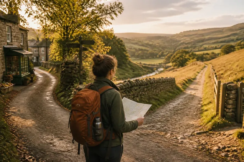
At a fork beside a stone wall, one path bends toward a village shop while the other crosses an open slope. A map may draw both as thin lines, but the first may serve a nearby errand and the second may continue between settlements. Reading a path as a walking line or a through route helps you describe its connections without mistaking a mapped segment for a complete journey.
A walking line links nearby places, such as a lane and a footbridge or a village and its fields. A through route carries movement between places farther apart, often by joining local paths, lanes, or crossings. The same segment can do both jobs; its role depends on the journey you are describing.
Walking line or through route
Start with two endpoints that make sense for a walker. For a local connection, choose nearby places: perhaps a village square and a neighboring hamlet, or a riverside lane and an upland road. For a through route, look beyond those immediate endpoints and ask whether the segment joins a sequence that continues toward other places.
Then name the path’s specific contribution. It might connect homes to a crossing, link two settlement streets, or carry a walker from one valley into another. A short segment can matter to a longer journey without becoming a through route on its own.
Imagine a mapped path that leaves a village lane, crosses a stream, and meets a road pointing toward the next settlement. If the question is how someone reaches the streamside fields, the path is a local walking line. If the question is how to travel between settlements, it may be one link in a through route—but only if the road and its onward connections provide a usable continuation.
Trace the connections
Follow both ends on the map rather than stopping at the sheet edge or first road crossing. Look for a lane, another footpath, a bridge, a settlement street, or another place where a walker could continue. This can show whether the segment completes a nearby connection or belongs to a longer chain.
Check what each end actually reaches. A path opening onto a village street may serve local trips, even if it continues across the map. A junction with another footpath does not by itself establish a through route: follow the next link and see whether it leads somewhere relevant.
Pay attention to breaks. A line that ends at a river, fenced edge, steep bank, or road may not offer a practical continuation. A detailed map may show a small link omitted from a broader map, or reveal that a path stops short of the crossing it seemed to reach. Treat the map as evidence about the line, not a complete account of access or conditions.
When a route enters a settlement, follow it through the streets instead of assuming it ends at the first one. A through route may cross the built-up area and leave on the far side. A local line may have reached its destination at a bridge, school, or cluster of homes. Its role can change along the way.
Read the terrain
Ridges, valleys, rivers, wet ground, and steep slopes help explain why paths follow particular lines. A valley floor may link nearby farms and villages while also offering a corridor between more distant places. A ridge may funnel movement toward a saddle or low pass.
Notice where a walker must choose a crossing or junction. A bridge, ford, pass, or gap can bring paths together. Several links serving nearby destinations may make it a local hub; a path continuing from one side toward a distant settlement may also contribute to a wider route.
Terrain suggests why a path runs where it does, but it does not establish who uses it or prove its role. Compare the available lines: a longer path may be the sensible connection around a steep slope, while a winding route may be the practical way through difficult ground. Shape alone is a poor guide to purpose.
Compare route scales
Read the path at a close scale, then zoom out. Up close, note its immediate endpoints and nearby destinations. At the wider scale, see whether those ends join a longer sequence. A walking line can be locally useful without continuing through, and a long-distance route can use a segment that also serves everyday trips.
Settlement edges, bridges, road crossings, and junctions often clarify connections better than a route name. A name may provide a clue, but it cannot establish that the path is continuous, accessible, or suited to a particular journey.
Maps also vary in detail. A broad map may simplify bends or omit a minor connection; a detailed map may reveal a lane behind buildings or a path that stops before a crossing. If maps differ, describe what each one shows rather than forcing them into a single uninterrupted line.
It is not worth the effort to assign every segment one permanent label. A path can change function from one junction to the next. Describe its local connection and any wider continuation separately instead of debating whether a short section “counts” as a through route.
Check passage and access
A path symbol does not necessarily show whether access is permitted, a crossing is open, or the ground suits a particular outing. Check posted notices and consult the relevant land manager or local authority for current access information. Follow local rules and avoid treating a mapped line as permission to cross private land.
Look closely at road, water, rail, and property-edge crossings. A route may depend on a bridge, gate, marked crossing, or permission that the map does not explain. A local link may still serve a nearby destination, while a through route depends on a connected passage along its length.
Keep your description specific. “A path linking the village lane with the riverside crossing” says what the segment connects. If it also leads toward another settlement, describe that continuation and note any uncertainty about whether walkers can use it.
Questions about path roles?
Can one path be both local and through?
Yes. A segment may connect nearby destinations and also form part of a longer journey. Name the endpoints for each role so readers can see how the interpretations differ.
Does a straight path count as a through route?
Not on its shape alone. Trace beyond both ends to see whether it joins a continuing sequence between places or simply reaches a nearby destination or obstacle.
What if the map shows no continuation?
Check a more detailed map and, where lawful and safe, inspect the relevant junction or crossing. If the connection remains uncertain, describe the mapped segment without claiming it completes a longer route.
Which role belongs in a route description?
Use the description that answers the reader’s question. For a nearby walk, name the local destination; for a journey between places, explain the wider sequence and identify uncertain links.
Describe the route clearly
Write the connections in the order a walker would encounter them: starting point, path segment, crossing or junction, and destination or onward link. Distinguish what the map shows from what the landscape suggests, so a plausible interpretation does not become an unsupported claim about use.
For the imagined streamside path, you might describe a local link from the village lane to the fields, then add that it meets a road toward the next settlement. That second connection matters only if the road offers a continuation for walkers; if you cannot establish that, say it remains uncertain.
Reading a walking line or through route is a way to describe connections at the scale that fits the journey. Trace the endpoints, check the crossings, and name both the nearby purpose and any wider link. Those details help someone understand what the path appears to connect without promising more than the map can tell you.